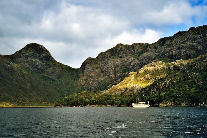
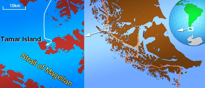
Aomi anchored at Tamar Island in the Strait of Magellan with an anchor and a long rope tied to a tree.
Do not rely solely on human-made navigational aids, including lighthouses, floating aids, or GPS. In times of war or natural disasters, these tools may become unavailable.
To ensure your safety, learn to determine your position at sea using multiple methods. Always be prepared for the possibility of equipment failure. Develop alternative plans and maintain a sense of readiness for any emergency.
Stay safe by diversifying your navigational skills and always having a backup plan.
Japanese sailing magazine KAZI
At that time, Aomi was sailing near the west entrance of the Strait of Magellan. Let's review the Strait of Magellan.
The Strait of Magellan
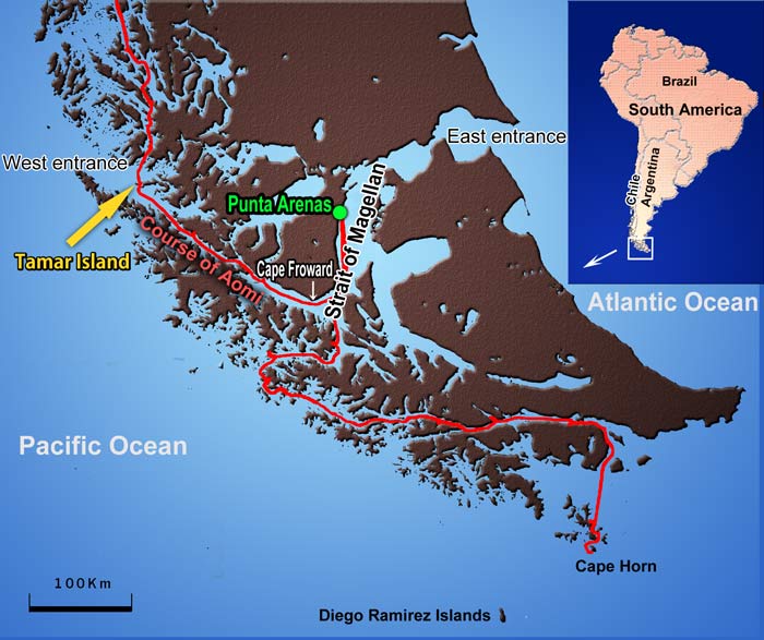
The Strait crosses the southern tip of South America, Patagonia, from east to west, connecting the Atlantic Ocean to the Pacific. South of the Strait lies a group of islands that stretch to Cape Horn. Technically, the southernmost point of South America is the Diego Ramírez Islands, about 100 km southwest of Cape Horn. The red line on the map above indicates Aomi's course through the Patagonian Archipelago.
After navigating the numerous Chilean islands for more than two months, Aomi entered the Strait and set a course for Tamar Island, intending to anchor there for the night. The waves, driven by the wind, combined with the Pacific swell, creating a tumultuous sea surface.
Covered by breaking waves, Aomi seemed to plunge underwater like a submarine. The Strait of Magellan is indeed known for its severe winds.
To safely enter the bay of Tamar Island, you must navigate between rocks. For safety, the Chilean Navy constructed a beacon at the entrance.
What is a Beacon?
I took these photos during the around-the-world navigation in Aomi. Beacons at sea include lighthouses, buoys, and radio beacons. The beacon mentioned here is a cylindrical white concrete landmark.
The entrance to Tamar Island's bay is difficult to find and dangerous due to the surrounding rocks. "No worries, there is a beacon at the entrance to show the right course," I reassured myself.
*
However, reality proved different.
Navigating to Tamar Island
The image below is part of Chilean nautical chart 1105. You can see "TAMAR" on the right side, with the anchorage marked by a red circle. To reach it, you must pass through an entrance flanked by dangerous rocks. The magnified image on the left shows the entrance in detail.
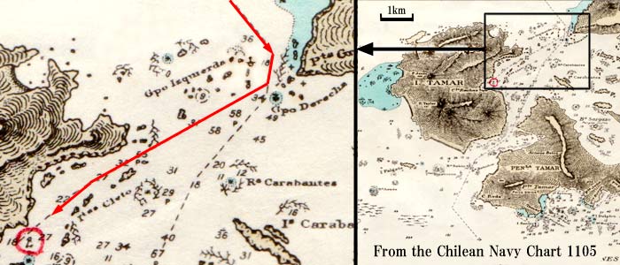
Numerals on the chart show the depth of water in meters. The areas tinted in faint blue are shallow waters. Numerous black dots are rocks. The symbols which look like seaweed shows kelp (a kind of giant seaweed). The red line is the right course to the anchorage.
The beacon’s position is indicated on the chart with a symbol and pointed out by a green arrow in the magnified image below. Many rocks shown on the chart might be hidden behind waves or underwater.
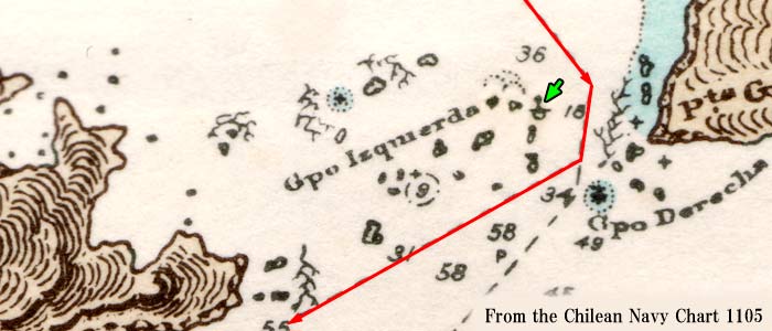
Despite the chart's information, the beacon was missing.
I had to locate Aomi's precise position by observing the shapes of the islands and rocks around me and watching for slight changes in the waves, which suggested hidden rocks. It was a tense and fearful experience.
*
After navigating through the danger, Aomi finally arrived at the anchorage. The scenery that greeted me was beyond imagination. In front of Aomi, a spectacular wild cliff rose high.
It’s impossible to fully capture the experience in photos or writing. I felt the power of something beyond human existence. It's easy to understand why big rocks or mountains have been objects of worship.
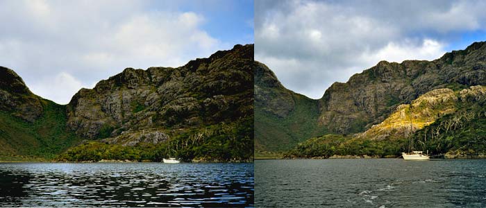
Sunlight pierced through a tiny hole in the clouds, illuminating the cliff and making the rock shine like gold. The mysterious glow shifted every second.
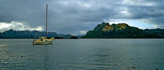
I took this photo in the same bay. Although Aomi remained in the same position, the camera angle was 180° different. The mountain on the right appeared in strange colors due to the faint sunlight, sometimes shining gold or pink.
The black dots on the water are kelp leaves, which can entangle propellers or anchors, causing a hazard.
During my days in the Patagonian Archipelago, I witnessed such scenery countless times. It felt like a wonderland or dreamland, making it hard to believe that everything around me was real.
It’s almost impossible to describe these experiences in photos or writing. Despite that, I can’t suppress the emotion to share them with YOU.
Back to main page.